
The flight was made in 4 stages:
Ahead, the mass of Bill Williams mountain and beyond, our first destination of Valle airport, 50 miles due south of the grand canyon village. 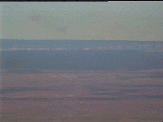 In the middle of an almost featureless plain, Valle airport is a welcome sign of civilisation. Out here, there are precious few place to land and Valle's tarmac runway is most inviting.
(On another day, I passed this way en route to
Monument Valley
. Click here to follow this journey instead.) 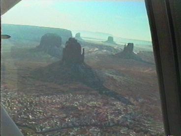
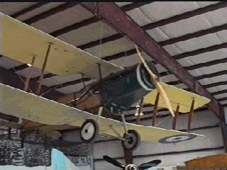
The FBO suggests runway 03, which turns out to be surprisingly narrow. A long taxiway leads to Valle's most impressive terminal, built many years ago for Grand Canyon Traffic. The duty officer is delighted to greet a visiting pilot - a rare occurrance - and drives me to breakfast at a nearby resturant. 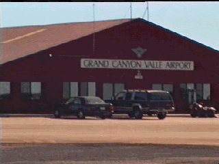 Valle is home to a new aircraft museum, which icludes several impressive WW1 replicas. Star of the show is Bristol fighter, immaculately copied from the original. Most of these replicas fly on special occasions.
Taxing out from Valle, it would be easy to get lost on the long and winding track to the main runway.
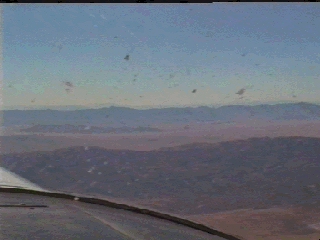
The south rim of the Grand Canyon dominates the view to the North. The distant cliffs are the North Rim, standing more that 1,000 ft above the south rim and often subject to arctic conditions. It was there that I once saw a lone wolf on one very early and very cold morning, ambling across the alpine meadows.The featureless plain ahead offers few visual clues, and an unexpected southerly wind blows my track closer to Grand Canyon controlled airspace than intended. Fortunately, the signal from Peach springs VOR keeps me out of trouble.
Further along my track to Kingman, visual clues return with the famous route 66 highway, which I know well and recognise immediately. To the North, I have a fine view of the Supai area of the Grand Canyon, one of the few places where trails lead down to the river. 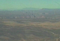 At last, and dead on course, the Kingman valley comes into sight.
Ahead in the desert, still invisible to me, is Kingman airport.
 Landing at Kingman is interesting. An individual on the gound advises runway 33 for landing, which is downhill and downwind. In the meantime, a large turboprop is flying training patterns on different runways in turn. As I circle the airport to look for the windsock, I wonder about the down slope on the advised approach.
However, the runway is very long and there are no obstructions at the far end. The little Cessna floats on and on, never wanting to land, but eventually slows to the stall and drops gently to the runway at about the mid-way point. No problem, but I am reminded the that it is the pilot's reponsibility to choose the correct runway at an uncontrolled airport, whatever the helpers on the ground might say.
Perhaps I should have had the nerve to ask the turboprop to hold off his antics while I chose a more sensible approach! Next time I will know what to do.
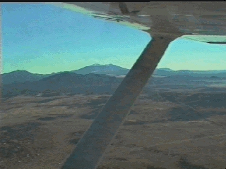
Out of Kingman, there is a stiff climb to clear the mountain ridge to the South East. The desert here seems to climb almost as fast as the little Cessna, although there is always plenty of ground clearance should a return to airport be needed.
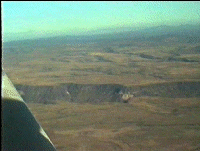
Over the ridge, and all of Eastern Arizona is spread before me. 180 miles ahead is Phoenix, invisible beyond the Earth's curvature, and on the way the little mining town of Bagdad. Otherwise, nothing but scenery.
Deep canyons carve into the plains to the East and present an inviting prospect on this windless day. However, commonsense says no: no matter how reliable the 110HP Lycoming feels, an engine failure low in one of those canyons could have only one outcome in this deserted land. Another day, perhaps.
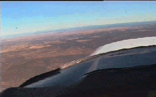
Ahead is the mining town of Bagdad. The vast opencast copper mine here dominates the landscape and helps explain Arizona's nickname of the 'The Copper State'. Bagdad's single runway is perched right on the edge of the opencast and the view from downwind is fascinating. No traffic answers my calls on the Unicom and when I land, I find that the place is deserted. 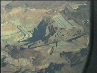
After a few minutes I take off to the West, soaring over the brink of the opencast, 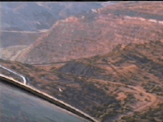 which falls away like the Grand Canyon itself. As I turn on course, Prescott's Granite Mountain already dominates the view although it is still 50 miles away on this perfect afternoon.
Approaching Prescott, much thought is given to the complex geometry of Prescott's busy traffic pattern, where 10 or more aircraft and two separate runways operate together. With no radar, the controllers rely on pilot reports and visual contact to keep traffic separated. In the event, I join the pattern smoothly, having learned at last a little of what to expect.
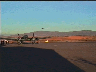
Taxying to the ramp, I see that a sizable part of the Confederate Air Force is in town, Including a B-17 and, of all things, an HE111.